
The Coastal Construction Control Line (CCCL) marks the state's jurisdictional boundary for the beach-dune system, and if your parcel sits seaward of it, you almost certainly need a permit from the Florida Department of Environmental Protection (FDEP) before you build, add on, or excavate. That single fact shapes every renovation timeline, insurance conversation, and closing document tied to Florida's sandy beaches. Your first move should always be the same: pull up FDEP's MapDirect tool and see exactly where that line falls on your lot.
TL;DR:
- Construction work seaward of the CCCL requires a permit from FDEP, especially for new homes, pools, or significant alterations, but routine maintenance often qualifies for exemptions.
- The CCCL is established through comprehensive engineering studies and considers storm data, erosion trends, and sea level rise, producing a 30-year shoreline projection for planning.
- Confirming whether your property crosses the CCCL involves overlay tools, GIS data, and potentially a licensed surveyor, with early professional input reducing project delays.
- State and local permits are separate, and coordination with both agencies is crucial to prevent delays or enforcement actions like stop-work orders.
- Rebuilding storm-damaged structures is possible under certain conditions, but unpermitted construction faces serious penalties, emphasizing the importance of obtaining proper approvals.
Table of Contents
- What the Coastal Construction Control Line Actually Regulates
- Where to Find the CCCL for Your Property
- Permits, Exemptions, and What FDEP Actually Reviews
- How the State Draws the Line: Legal Basis and Engineering Factors
- Your Practical Path From Discovery to Approval
- Coordinating CCCL Review With Local Permits and Flood Codes
- Enforcement, Storm Rebuilding, and Your Appeal Rights
- How Craneisland Approaches Coastal Stewardship
- Balancing Development and Beach Protection
- Sources
- FAQ
What the Coastal Construction Control Line Actually Regulates
The CCCL was born from Florida's Beach and Shore Preservation Act, codified in Chapter 161 of the Florida Statutes. It exists because Florida's beach-dune systems absorb the punishment that would otherwise reach homes and roads. Engineers set each line using storm surge modeling tied to a 100-year storm event, the same statistical benchmark used in floodplain science, to mark where wave action and erosion are expected to behave unpredictably over time.
A common misread is that the line bans construction outright. It doesn't. It triggers a review process. Here's what tends to trip people up:
- "Seaward of the line means no building." False. It means state-level review of siting, design, and elevation before local permits proceed.
- "The CCCL and the flood zone are the same thing." They're related but separate; a property can sit inside an AE or VE flood zone under the National Flood Insurance Program while also facing separate CCCL jurisdiction.
- "Older homes are grandfathered from all rules." Existing structures have some protections, but any substantial alteration usually reopens the review.
Where to Find the CCCL for Your Property
FDEP has established control lines in 25 coastal counties with sandy beach frontage, and Amelia Island's shoreline in Nassau County falls within that mapped system. Confirming your parcel's status takes three practical steps:
- Open FDEP MapDirect. The interactive tool overlays the control line, shown as a solid red boundary, directly onto parcel data so you can see your lot's relationship to it in minutes.
- Cross-check the GIS dataset. FDEP's geodata service hosts the same line data in a format architects and civil engineers can pull into site plans.
- Verify with a licensed surveyor. Monuments and recorded county plats sometimes reflect boundary nuances that a screen overlay can't capture precisely.
Pro Tip: If MapDirect shows your structure straddling the line, don't guess. A coastal engineer can run a site-specific determination that will hold up during permit review, and it's far cheaper than a stop-work order mid-project.
Permits, Exemptions, and What FDEP Actually Reviews
Construction seaward of the control line generally requires an FDEP permit unless the work qualifies for an exemption. Larger projects, new homes, seawalls, and pools typically need a full field permit with engineering review. Minor work often qualifies for an administrative review, which moves faster.
Common exemptions cover routine maintenance that never touches the foundation:
- Re-roofing without structural changes
- Repainting, siding replacement, or window swaps
- Minor landscaping that doesn't disturb dune vegetation
- Repair of existing walkways at the same footprint
FDEP's review focuses on dune integrity, native vegetation, sea turtle nesting habitat, and public beach access. A roof replacement on an existing home usually sails through as exempt. Extend the foundation, add a pool seaward of the structure, or reconfigure a seawall, and you're now in full permit territory with engineering reports, elevation data, and often a public notice period attached. The difference between those two scenarios is the entire reason this system exists.
How the State Draws the Line: Legal Basis and Engineering Factors
Setting a CCCL isn't a desk exercise. Chapter 161, Section 161.053 requires a comprehensive engineering study, a topographic survey, and a public hearing before FDEP can establish or revise a line. That process pulls together historical storm data, tidal range, offshore bathymetry, long-term erosion trends, and vegetation patterns along the shoreline.
The statute directs FDEP to consider the historical storm and hurricane record, predicted erosion trends, the local rate of sea level change, and existing upland development when determining where severe fluctuations in beach-dune topography are likely to occur.
For property owners, this technical process produces two practical tools worth knowing: the 30-year erosion projection, which estimates where the shoreline will sit several decades out, and development agreements, which let owners negotiate site-specific conditions with FDEP rather than defaulting to a strict denial. Both are covered in detail in FDEP's CCCL FAQ.
Your Practical Path From Discovery to Approval
Once you know your parcel touches the control line, the sequence that saves the most time looks like this:
- Confirm the line's exact location using MapDirect and a licensed survey.
- Contact your local building official early, since county review often runs alongside FDEP's.
- Hire a coastal engineer to prepare the site survey, 30-year erosion projection, and any structural reports the permit requires.
- Assemble the full application package, including elevation data and vegetation surveys where applicable.
- Submit and track review, budgeting for both state and local timelines to run in parallel rather than back to back.
Costs break into three buckets: survey work, engineering and permitting fees, and any structural design changes the review requires. Timelines vary by project complexity, but the applications that move fastest are the ones where the survey and erosion projection arrive complete on day one.
Pro Tip: Ask your engineer for the development agreement option upfront if your site is borderline. Negotiating conditions before you're denied is far more efficient than appealing after the fact.
Coordinating CCCL Review With Local Permits and Flood Codes
FDEP's control line permit and your county's building permit are not the same approval, and both are often required before you break ground. Section 161.052 adds a separate a setback from mean high water in many jurisdictions, layering another state-level requirement on top of local zoning.
- Elevation certificates tied to the National Flood Insurance Program often need to align with CCCL-mandated design elevations.
- The Florida Building Code's coastal construction provisions can duplicate or reinforce FDEP's structural requirements, so check both early.
- Local floodplain administrators and FDEP reviewers don't always talk to each other automatically; you're often the connecting thread.
Coordination friction between state and county reviewers is one of the most common causes of project delay, so looping in both offices before you finalize design saves real time.
Enforcement, Storm Rebuilding, and Your Appeal Rights
Building seaward of the control line without authorization carries real consequences, and FDEP treats unpermitted work seriously.
- Unauthorized construction can trigger stop-work orders, fines, and mandatory removal or retrofitting at the owner's expense.
- Storm-damaged structures can generally be rebuilt, but the rules governing reconstruction depend on the extent of damage and whether the rebuild meets current siting and design criteria, as outlined in FDEP's CCCL FAQ.
- Owners who disagree with a permit denial can request administrative review or pursue a development agreement, and judicial review remains available as a final recourse.
The system is built to allow reasonable rebuilding and reasonable use, not to freeze every coastal lot in place.
How Craneisland Approaches Coastal Stewardship
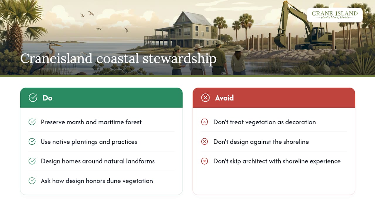
At Craneisland, we've shaped every homesite on Amelia Island around the land it sits on, not against it. Preserved marshlands, maritime forest, and native plantings aren't decorative afterthoughts. They're the framework our wildlife-friendly neighborhood practices and maritime forest stewardship are built around. Buyers weighing a coastal lot elsewhere should ask the same questions we ask ourselves: how does the design honor dune vegetation, and who selected the architect with the shoreline in mind?
Balancing Development and Beach Protection
Florida's coastal rules exist to keep homeowners from building somewhere the ocean will eventually reclaim, not to punish anyone for owning oceanfront property. The owners who fare best treat their regulator as a design partner from day one, not an obstacle discovered at closing. Some communities approach development by weaving homes into preserved marsh and forest rather than around them, reflecting an instinct to respect natural surroundings on a community scale. Call your local building official and FDEP before you finalize a site plan, not after.
— John Hillman
Sources
- LOCATE the Coastal Construction Control Line (CCCL) | Florida DEP
- 161.053 Coastal construction and excavation; regulation on county basis — Florida Statutes
FAQ
What Is the Coastal Construction Control Line?
It's Florida's state-defined jurisdictional boundary marking the beach-dune area subject to severe fluctuation during a 100-year storm, established under Chapter 161 of the Florida Statutes.
How Do I Check if My Property Is Seaward of the CCCL?
Use FDEP's MapDirect tool to view the control line overlaid on your parcel, then confirm with a licensed surveyor if your structure sits near the boundary.
Do I Always Need a Permit to Build Seaward of the Line?
Not always. Minor maintenance that doesn't touch the foundation, like re-roofing or repainting, is commonly exempt, but new construction, additions, and foundation work require an FDEP permit.
What's the Difference Between the CCCL and a Flood Zone?
The CCCL is a separate state regulatory boundary from flood zones like AE or VE under the National Flood Insurance Program, though the two often overlap on coastal parcels and both can apply to the same project.
Can I Rebuild a Home Destroyed by a Storm if It's Seaward of the CCCL?
Generally yes, but the rebuild must meet current siting and design criteria, and the extent of storm damage affects what FDEP allows during reconstruction.