
Maritime forest communities are narrow, upland coastal woodlands running from North Carolina to Florida, adapted to salt spray and wind, and among the rarest biological communities on the U.S. Atlantic coast. According to the U.S. Fish and Wildlife Service, these forests occupy a discontinuous band on stabilized dunes and old ridges, providing groundwater storage, soil stabilization, and critical wildlife refugia. NOAA's Ocean Service confirms they are upland systems, not wetlands, meaning they tolerate salt spray but cannot survive with standing saltwater at their roots. That distinction matters for both conservation planning and development decisions.
Their current status is fragile. Fragmentation from coastal development, sea-level rise, and saltwater intrusion are shrinking and degrading these forests faster than most people realize. NatureServe tracks many regional variants as rare or imperiled, and the New York Natural Heritage Program (NYNHP) documents similar rankings for northeastern occurrences. Three things you can do right now:
- Support land trusts and conservation easements that protect upland dune ridges from development
- Avoid clearing or draining maritime forest soils, which disrupts the groundwater balance these communities depend on
- Contribute observations to regional monitoring programs or contact your state's Natural Heritage Program to support ongoing inventory work
Table of Contents
- What makes maritime forests different from marshes and mangroves?
- Where do maritime forests occur along the U.S. coast?
- What ecosystem services do maritime forests provide?
- How can you conserve and restore maritime forest communities?
- Three case studies that show what works and what doesn't
- Key Takeaways
- Why protecting these forests is the most urgent coastal conservation decision of this decade
- Useful sources for further research
- FAQ
What makes maritime forests different from marshes and mangroves?
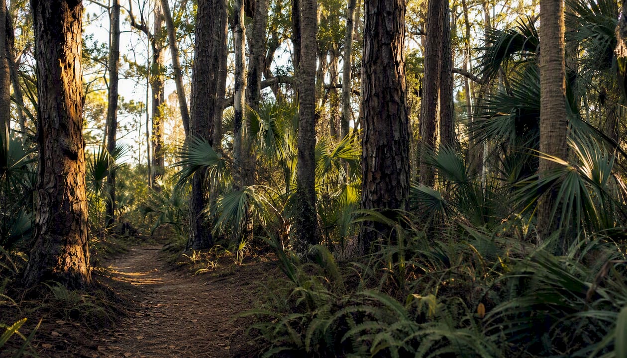
The defining trait of a maritime forest is where it sits: on stabilized, well-drained upland soils behind the primary dune, not in standing water. That single fact separates it from the salt marsh, the mangrove swamp, and the tidal swamp forest that often surround it on a barrier island. The trees and shrubs here have adapted to airborne salt, not waterlogged roots.
| Feature | Maritime Forest | Salt Marsh | Mangrove | Inland Coastal Forest |
|---|---|---|---|---|
| Soil type | Well-drained upland sand | Saturated, saline muck | Waterlogged, saline | Moist to mesic upland |
| Salt exposure | Salt spray (airborne) | Tidal saltwater flooding | Tidal saltwater flooding | Minimal |
| Dominant plants | Live oak, pines, wax myrtle | Spartina, Salicornia | Red, black, white mangrove | Mixed hardwoods, pines |
| Elevation | Above tidal influence | Intertidal zone | Intertidal zone | Variable, often higher |
| Conservation pressure | High (development targets stable soils) | Moderate (wetland protections) | Moderate (wetland protections) | Lower |
The conservation implication of this difference is significant. Because maritime forest soils are stable, well-drained, and buildable, they attract residential and commercial development far more than adjacent wetlands, which carry legal protections. Marshes and mangroves benefit from federal and state wetland regulations; maritime forests often do not. That regulatory gap leaves them exposed.
NOAA's Ocean Today describes these forests as resembling historic woodlands, places where biodiversity concentrates in a narrow strip between open beach and interior upland. Authoritative community boundaries are mapped through NatureServe, FWS community profiles, and NOAA resources, all of which use the upland soil criterion as the primary diagnostic. When you are evaluating a site, start there.
Where do maritime forests occur along the U.S. coast?
The primary range runs along barrier islands and adjacent mainland shores from North Carolina south through Florida, with isolated occurrences extending northward to Long Island, New York. The distribution is inherently discontinuous: these forests occupy narrow strips on stabilized dune ridges, and many individual patches are small, isolated, and separated by developed land or open water.
| Region | Representative Sites | Dominant Species | Conservation Notes |
|---|---|---|---|
| Northeast (NY–NJ) | Fire Island National Seashore | Pitch pine, American holly, black cherry | Documented groundwater rise and recruitment failure |
| Mid-Atlantic (VA–NC) | Outer Banks, Currituck | Live oak, loblolly pine, wax myrtle | Fragmented; storm-vulnerable |
| South Atlantic (SC) | Kiawah Island, Isle of Palms | Live oak, sabal palm, wax myrtle | Kiawah Conservancy active in protection |
| Southeast (GA–FL) | Big Talbot Island, Amelia Island | Live oak, cabbage palm, saw palmetto | State parks and conservation easements present |
| South Florida | Canaveral, barrier islands | Sand live oak, saw palmetto, gumbo limbo | Subtropical variants; hurricane exposure |
The FWS community profile documents community types and geographic distribution in detail, noting that the term "maritime forest" itself has been applied inconsistently across studies, which complicates range estimates. NatureServe and state Natural Heritage Programs, including NYNHP, provide the most current and jurisdictionally precise distribution data. If you are working in a specific state, your state heritage program is the right first call for mapped occurrences and rarity rankings.
For readers near the Amelia Island region, the Big Talbot Island and Amelia Island corridor represents one of the most intact and well-studied examples of Florida maritime forest, with public lands and conservation easements protecting significant acreage. Craneisland's commitment to preserving the natural forest character of its community reflects the same values that make this region ecologically significant. Exploring wildlife-friendly neighborhoods in this corridor shows how conservation and community can share the same ground.
What ecosystem services do maritime forests provide?
The services these forests deliver are not abstract. They are measurable, place-specific, and in many cases irreplaceable by engineered alternatives.
"Maritime forests help conserve nutrients and groundwater and protect coastline stability. They are important shoreline ecosystems on barrier islands, often resembling historic woodlands that support high plant and animal diversity."
— NOAA Ocean Today
Storm buffering is the most visible service. The dense canopy and root mass of a mature maritime forest absorbs wind energy, reduces surge velocity, and anchors dune soils against erosion. Behind an intact forest, structures and habitats experience measurably lower storm damage than those exposed on cleared land. This is not a theoretical benefit; it is the reason coastal engineers increasingly advocate for living shorelines and forest retention over hardened seawalls.
Groundwater storage is equally important and less discussed. Maritime forest soils hold freshwater in the dune matrix, maintaining a freshwater lens that resists saltwater intrusion from below. When forests are cleared and soils are compacted or paved, that lens collapses, accelerating the very saltwater intrusion that threatens remaining forest patches.
Habitat value is substantial. Migratory songbirds use maritime forest patches as stopover sites during spring and fall migration, and the dense canopy provides nesting cover for species that cannot use open marsh or beach. Terrestrial mammals, reptiles, and invertebrates depend on the forest interior for shelter and food. Because maritime forests are rare and fragmented, each intact patch functions as a refugium, a biological island in a sea of developed or degraded land.
Carbon sequestration and nutrient cycling round out the service profile. Live oak-dominated forests store significant above-ground and below-ground carbon, and the leaf litter and root turnover cycle nutrients that would otherwise leach into adjacent estuaries.
How can you conserve and restore maritime forest communities?
Conservation of these forests works at two scales: landscape protection to prevent further loss, and site-level restoration to recover degraded patches. Both are necessary, and neither works well without the other.
At the landscape scale, the priority is protecting continuous upland dune ridges from development. Conservation easements, fee-simple acquisition by land trusts, and local zoning that restricts clearing on stabilized dune soils are the most effective tools. The Oceanography Society is clear that protecting a continuous forest spine is more effective than piecemeal preservation; connectivity is the variable that determines whether a forest can recover after a storm.
Hydrology management is equally critical. Avoid drainage alterations that lower the water table in upland areas or increase the rate of saltwater intrusion. Holistic planning that treats marsh, dune, and maritime forest as an integrated unit prevents the maladaptive interventions, such as drainage fixes that inadvertently raise soil saturation and kill maritime forest seedlings, that the Rutgers research documents.
For site-level restoration, the sequence matters:
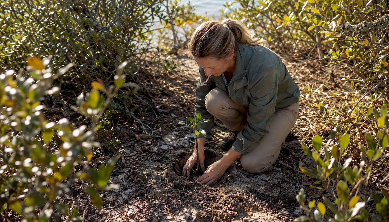
- Begin plantings at the windward margin with salt-tolerant nurse shrubs (wax myrtle, groundsel tree) before introducing live oak or holly seedlings to the interior.
- Use locally sourced nursery stock to preserve regional genetic adaptation.
- Fence restoration areas from foot traffic during establishment, as trampling of the windward shrub layer is one of the most common causes of restoration failure.
- Select planting sites on well-drained soils above the projected groundwater rise elevation, using the Resilient Coastal Forests technical guide to overlay forest cores with risk maps and identify the most defensible restoration sites.
In the southern range, prescribed fire can play a role where historically appropriate, particularly in pine-dominated variants. Coordination with local fire management agencies and emergency planners is required before any burn program begins.
Pro Tip: Stage restoration plantings landward of the anticipated groundwater rise boundary, and establish nurse-shrub windbreaks first. Planting live oak seedlings into an unprotected, salt-exposed site without a shrub buffer is one of the most common and costly restoration mistakes.
Communities that integrate these principles into their planning, as Craneisland does on Amelia Island, demonstrate that preservation-based development and ecological integrity can reinforce each other rather than compete.
Three case studies that show what works and what doesn't
Fire Island, New York
Fire Island National Seashore holds one of the best-documented examples of maritime forest dynamics in the Northeast. Rising groundwater has caused measurable canopy mortality and ghost forest formation along the forest's seaward edge. Seedling recruitment has declined in low-elevation patches, consistent with the Rutgers findings on groundwater-driven mortality. The management lesson here is stark: monitoring groundwater depth is not optional. By the time canopy dieback is visible, the window for intervention has often already closed.
"Ghost forests — stands of dead trees exposed on beaches — are a common visual indicator of maritime forest retreat, driven by rising groundwater and saltwater intrusion."
— NOAA Ocean Service
Kiawah Island, South Carolina
The Kiawah Conservancy has documented the role of the island's intact forest spine in maintaining land stability against wind and surge. The Oceanography Society's analysis highlights Kiawah as an example of how biological integrity, specifically continuous, unfragmented forest, determines whether an island holds together under storm stress. Land-protection successes on Kiawah have come through a combination of conservation easements, land trust acquisitions, and community commitment to limiting clearing. The lesson: connectivity is not just an ecological value; it is a structural one.
Big Talbot Island and Amelia Island, Florida
| Site | Conservation Tool | Key Outcome |
|---|---|---|
| Big Talbot Island State Park | State acquisition | Large intact maritime forest block protected |
| Amelia Island corridor | Conservation easements, private stewardship | Fragmentation slowed; public access maintained |
| Crane Island community | Preservation-based development | Forest and marsh character integrated into homesite design |
The Amelia Island region offers a model worth studying. State park acquisition at Big Talbot Island protects a large, intact block of maritime forest with public access for research and recreation. Along the broader corridor, conservation easements and private stewardship have slowed fragmentation. Craneisland's approach on Amelia Island, integrating preserved marshlands and forest character into the community's design, reflects the same principle: that the forest is not a backdrop but a foundation. For readers considering coastal living in Florida, the Amelia Island corridor demonstrates that thoughtful stewardship and quality of life are not in tension.
Key Takeaways
Maritime forest communities are rare, upland coastal woodlands that provide irreplaceable storm buffering, groundwater storage, and biodiversity habitat, and their survival depends on protecting continuous forest spines from development, drainage alteration, and sea-level rise.
| Point | Details |
|---|---|
| Upland, not wetland | Maritime forests grow on well-drained dune soils and tolerate salt spray, not standing saltwater at their roots. |
| Fragmentation is the core threat | A fragmented forest cannot buffer storms or recover from disturbance the way a continuous forest spine can. |
| Groundwater rise drives ghost forests | Rising groundwater kills roots and prevents seedling recruitment, producing visible ghost forests at forest margins. |
| Nurse shrubs first in restoration | Establish salt-tolerant windbreak shrubs before planting live oak or holly seedlings to protect interior plantings. |
| Map cores before you act | Use NatureServe, FWS, and Resilient Coastal Forests GIS tools to identify defensible forest cores before committing restoration resources. |
Why protecting these forests is the most urgent coastal conservation decision of this decade
The conventional framing around maritime forest conservation tends to treat it as one item on a long list of coastal priorities, somewhere below sea turtle nesting beaches and above general "green space." That framing is wrong, and the evidence in this article shows why.
Maritime forests are the structural backbone of barrier islands. When they go, the island's capacity to absorb storm energy, store freshwater, and support terrestrial biodiversity goes with them. Marshes and dunes are important, but they cannot substitute for what a mature live oak canopy does. The ghost forests appearing along the Atlantic coast right now are not a future scenario; they are a present-day signal that the window for intervention is narrowing.
What concerns me most is the regulatory gap. Wetlands have legal protection. Maritime forests, despite being rarer and in many cases more ecologically complex, often do not. That asymmetry means the most buildable, most valuable, and most irreplaceable coastal habitat is also the least protected. Closing that gap requires local zoning, conservation easements, and community commitment, not just federal policy.
The communities that will fare best under accelerating sea-level rise are the ones that kept their forests intact. Craneisland's preservation-first approach on Amelia Island is not just an aesthetic choice; it is a long-term resilience strategy. Local governments, land trusts, and homeowners working together, as they have in the Kiawah and Amelia Island corridors, are the model. The science is clear. The question is whether enough people act on it before the next major storm makes the decision for them.
Useful sources for further research
The following primary sources and organizations provide the most authoritative information on maritime forest communities for managers, researchers, and conservation-minded residents:
- Ecology of maritime forests of the southern Atlantic Coast: a community profile | FWS.gov
- What is a maritime forest? | NOAA Ocean Service
- Maritime Forests | Ocean Today — NOAA
- Impacts of Climate Change on Coastal Forests in the Northeast US | Rutgers climate resource center
- Coastal Forests (U.S. National Park Service)
- TECHNICAL GUIDE FOR ASSESSING AND PLANNING FOR RESILIENT COASTAL FORESTS
For jurisdiction-specific distribution data and rarity rankings, contact your state's Natural Heritage Program (NatureServe network) or state forestry agency. Coastal property owners in the Southeast can also consult coastal market resources for regional context on conservation-oriented communities.
FAQ
Where are maritime forests located?
Maritime forests occur in a discontinuous band along barrier islands and adjacent mainland shores from North Carolina to Florida, with isolated occurrences as far north as Long Island, New York. They occupy stabilized upland dune ridges above tidal influence.
What makes maritime forests rare?
Their rarity comes from the narrow, specific conditions they require: stabilized dune soils, upland elevation above tidal flooding, and proximity to the coast. Development pressure concentrates on exactly these stable, buildable soils, making maritime forests among the most threatened coastal habitats in the eastern United States.
What is maritime vegetation?
Maritime vegetation refers to plants adapted to salt spray, wind, and sandy soils in coastal environments. In a maritime forest, this includes evergreen species like live oak, wax myrtle, American holly, and southern pines, which use waxy leaves, flexible branching, and dense shrub layers to survive airborne salt exposure.
What are forest-dependent communities in a conservation context?
Forest-dependent communities are species assemblages, including migratory birds, terrestrial mammals, reptiles, and native plants, that rely on intact forest habitat for nesting, foraging, shelter, or reproduction. In maritime forests, these communities are especially vulnerable because the forest patches are small, isolated, and surrounded by open water or developed land.
How do maritime forests differ from mangroves?
Mangroves grow in tidal saltwater, with roots submerged or regularly flooded. Maritime forests grow on upland, well-drained soils and are exposed to salt only through airborne spray. The two systems often occur near each other on barrier islands but occupy entirely different ecological niches and require different management approaches.