
Environmentally sensitive development is the planning and building approach that protects critical ecological functions by minimizing disturbance and treating stormwater, habitat, and soils as design constraints rather than problems to engineer away. The goal, plainly stated, is to make a finished site behave hydrologically the way it did before anyone broke ground. Three named frameworks anchor this work: the EPA's Construction General Permit under NPDES, the LEED certification system from the U.S. Green Building Council, and Low Impact Development, or LID, the family of techniques that infiltrate and filter rainwater close to where it falls.
For anyone standing at the start of a project, three moves matter more than the rest:
- Identify wetlands, floodplains, and habitat constraints before you sketch a single building footprint.
- Design for infiltration and buffers first, drainage pipes second.
- Bring permitting agencies into the conversation early, not after your site plan is finalized.
Quick fact: Case studies compiled by Geosyntec found that LID and environmentally sensitive site design measurably reduce peak stormwater runoff and pollutant loads compared to conventional pipe-and-curb systems. That's not a marginal footnote. It's the technical case for why this approach is spreading from coastal subdivisions to city stormwater ordinances nationwide.
Key Takeaways
Environmentally sensitive development succeeds when site assessment happens before design, LID techniques replace conventional drainage, and agencies get engaged early rather than late.
| Point | Details |
|---|---|
| Assess before you design | Commission wetland delineation, floodplain mapping, and soils testing before finalizing any site layout. |
| Design LID-first | Prioritize bioretention, porous pavement, and native landscaping over conventional pipe-and-curb drainage. |
| Engage agencies early | Schedule pre-application meetings and joint site visits before submitting formal permit applications. |
| Protect features during construction | Fence off preservation zones and inspect erosion controls weekly under Construction General Permit standards. |
| Monitor and adapt after completion | Track peak flow reduction and infiltration rates to prove performance and support future permits. |
| Craneisland demonstrates the model | A small number of carefully preserved homesites on Amelia Island illustrates how disciplined, low-impact planning can coexist with luxury residential development. |
Table of Contents
- What Counts as an Environmentally Sensitive Area
- Why Sensitive Site Design Actually Pays Off
- Core Principles That Should Shape Your Site Plan
- Low Impact Development Techniques Worth Specifying
- Navigating Permits Across Federal, State, and Local Lines
- What to Study Before You Draw a Site Plan
- Protecting Sensitive Features During Construction
- Where Projects Get Stuck, and How to Get Unstuck
- A Step-by-Step Path From Assessment to Monitoring
- Evidence That Sensitive Design Performs as Promised
- Shifting From Moving Water Away to Managing It as an Asset
- How Crane Island Puts These Principles Into Practice
- Sources
- FAQ
What Counts as an Environmentally Sensitive Area
Not every parcel needs this level of care, and knowing the difference saves time and money before design work even starts. An area typically qualifies as environmentally sensitive if it includes one or more of the following:
- Wetlands, whether tidal marsh or freshwater, mapped or unmapped
- Land inside the 100-year floodplain, per FEMA's flood maps
- Documented habitat for threatened or endangered species
- Steep slopes prone to erosion, generally of moderate to high steepness
- Coastal marshes, dune systems, or shoreline buffers
- Groundwater recharge zones or areas near private wells
Here's where a lot of confusion creeps in: environmentally sensitive development and green building are not the same discipline, even though people use the terms interchangeably. Green building, the kind LEED and Energy Star certify, focuses on a structure's performance. Materials, energy use, indoor air quality, water fixtures inside the walls. Environmentally sensitive development happens at the site scale, before the building's first stud goes up. It's about how the land itself gets touched. A LEED Platinum building can still sit on a site that destroyed a functioning wetland during grading. The two disciplines complement each other, but only one of them asks whether the site should have been developed the way it was in the first place.
A practical red flag test: if a title search or county GIS map shows recorded wetlands, a FEMA flood zone designation, or a species habitat overlay on your parcel, you're not doing a standard build. You're doing environmentally sensitive development, whether you planned to or not.
Why Sensitive Site Design Actually Pays Off
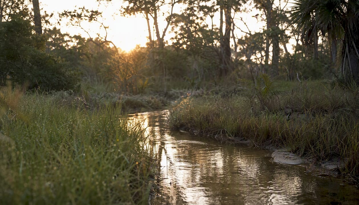
The ecological argument gets made often enough that it risks sounding abstract. It isn't. Wetlands and forested buffers filter pollutants out of runoff before it reaches a creek or estuary, recharge groundwater that supplies wells and streams during dry months, and maintain the habitat corridors that let wildlife populations survive fragmentation. Lose those functions on one parcel and the downstream effects show up as algae blooms, eroded stream banks, and dried-up wells a mile away.
The regulatory case is just as concrete. Projects that disturb wetlands or discharge stormwater without proper controls face enforcement action, stop-work orders, and retroactive mitigation costs that dwarf what proactive design would have cost. Meeting NPDES Construction General Permit requirements from day one, rather than scrambling to fix a violation, tends to move permits through review faster, not slower.
Then there's the financial and community angle, which developers underestimate more than any other:
- Native landscaping and infiltration-based stormwater systems generally cost less to maintain long-term than mowed turf and mechanical drainage infrastructure.
- Preserved marshland views, mature tree canopy, and walkable green space consistently command a premium in coastal real estate markets.
- Communities that visibly protect shared natural resources tend to face less public opposition and fewer contentious hearings than developments perceived as bulldozing everything in sight.
Quick fact: According to EPA guidance, sites designed with LID in place of traditional conveyance systems show reduced streambank erosion and improved water quality outcomes over time. That's a maintenance bill deferred for decades, not just a compliance checkbox.
Core Principles That Should Shape Your Site Plan
Every successful sensitive-site project traces back to a handful of design principles, applied before anyone touches a shovel.
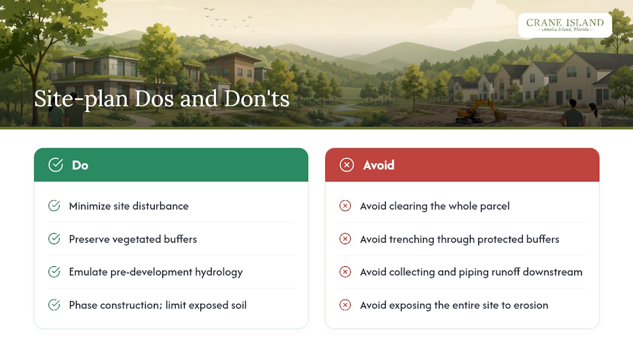
Minimize disturbance, or "fingerprint" the site. Instead of clearing the whole parcel and rebuilding landscaping afterward, mark the smallest possible footprint for buildings, roads, and utilities, and fence off everything outside that line before construction equipment arrives.
Preserve critical buffers. Wetland edges, stream corridors, and steep slopes need vegetated setbacks, not just on paper but physically protected during grading.
Emulate pre-development hydrology. The volume and timing of runoff leaving the site after construction should closely resemble what left it as a forest or meadow, which is the entire logic behind LID.
Treat stormwater at the source. Rather than collecting runoff and piping it downstream, infiltrate and filter it close to where rain actually falls.
Maintain wildlife connectivity. Isolated habitat patches lose value fast. Corridors linking preserved areas keep species populations viable.
Phase construction to limit exposed soil. Grade and stabilize in stages rather than exposing the entire site to erosion at once.
These principles drive real layout decisions. If you're preserving 40 percent of a parcel's steep-slope acreage, that's not a landscaping afterthought. It means clustering homesites on the flattest, most stable ground, running roads along contour lines instead of straight through them, and routing utilities to avoid trenching through protected buffers.
Pro Tip: Translate percentage-based preservation targets into an actual boundary line on your survey before you hire a civil engineer. A "preserve 40 percent of steep slopes" instruction is meaningless until it's drawn as a fixed no-disturb zone on the plat. Engineers design around lines, not percentages.
Low Impact Development Techniques Worth Specifying
LID isn't one product. It's a toolkit, and the right combination depends on soil type, groundwater depth, and scale. The Low Impact Development Center's core techniques include bioretention cells and rain gardens, porous pavement, green roofs, cisterns for rainwater harvesting, flow-through planters, tree boxes, disconnected impervious surfaces, and native or low-input landscaping in place of turf.
Each comes with siting caveats that matter more than marketing brochures admit. Bioretention needs reasonably permeable soil; it underperforms in heavy clay unless you engineer an underdrain. Porous pavement clogs with sediment if it isn't maintained and struggles in freeze-thaw climates without proper base design. Green roofs add structural load and need irrigation during establishment. Anything designed to infiltrate water near a private well needs a documented setback, since groundwater protection near wells deserves the same caution as any other supervised design decision, not an afterthought bolted on later.
| Scale | Common techniques | Primary benefit | Common constraint |
|---|---|---|---|
| Parcel (single lot) | Rain gardens, cisterns, disconnected downspouts, native landscaping | Reduces individual lot runoff and irrigation demand | Requires homeowner maintenance buy-in |
| Streetscape | Bioretention swales, tree boxes, porous sidewalks | Treats road runoff before it reaches storm drains | Utility conflicts underground, snow-plow damage risk |
| Neighborhood | Regional bioretention basins, constructed wetlands, preserved buffer networks | Manages cumulative runoff and preserves habitat connectivity | Higher upfront design cost, shared maintenance governance needed |
For low-input landscaping specifically, choosing regionally native plant palettes cuts irrigation and fertilizer needs dramatically compared to conventional turf, a point covered in more depth in guidance on sustainable yard landscaping. Communities weaving native plantings into shared open space, rather than treating each lot in isolation, tend to get better ecological performance from the same design budget, an approach explored in how nature and design shape luxury communities.
Navigating Permits Across Federal, State, and Local Lines
Permitting for environmentally sensitive development rarely runs through one office, which is exactly why so many projects stall. At the federal level, the Clean Water Act governs wetland fill through Section 404 permits, and the EPA's NPDES Construction General Permit covers stormwater discharge during construction on sites over one acre. FEMA flood maps determine whether your parcel falls in a regulated floodplain requiring elevation certificates or design restrictions. Layer on state environmental agencies, which often have their own wetland and buffer rules stricter than federal minimums, and local planning and zoning boards, which control lot layout, setbacks, and open space requirements.
The practical sequence that avoids the worst delays: request a pre-application meeting with your local planning department before finalizing a concept plan, schedule a joint site visit with wetland and stormwater reviewers so everyone sees the constraints firsthand, and use LEED or SITES credit language to frame your design intent in terms reviewers already recognize.
Developers who convene planning staff early and arrive with comparative performance data on their proposed LID layout, rather than a finished plan asking for a variance after the fact, tend to secure zoning flexibility without a major redesign. Presenting the numbers up front changes the conversation from "why should we allow this" to "here's how this performs."
Timeline expectations vary by jurisdiction, but a realistic planning horizon runs three to six months for local zoning and site plan review, and often longer when wetland delineation or a Section 404 permit is involved. Building in that lead time from the start, rather than discovering it mid-project, is the single biggest difference between smooth and painful permitting.
What to Study Before You Draw a Site Plan
Skipping technical assessments to save a few weeks upfront is the single most expensive mistake in this field, because rework after design almost always costs more than the study would have. A prioritized list, roughly in the order you should commission it:
During due diligence, before you're under contract or right after: wetland delineation, floodplain and topographic mapping against FEMA's flood insurance maps, and a preliminary soils and infiltration test to confirm the site can even support the LID approach you're planning.
During schematic design: species and habitat surveys, a detailed hydrologic baseline documenting how water currently moves across the site, and mapping of any groundwater well locations that need protective setbacks.
Post-permit or pre-construction: refined soils testing at actual building and infiltration locations, since preliminary borings rarely capture every variation across a large parcel.
Every one of these findings should feed directly into your concept layout. A wetland delineation that shifts the buildable envelope by twenty feet changes where roads go. A soils report showing shallow bedrock rules out deep infiltration trenches and points you toward surface bioretention instead. Skip the sequence and you'll be redesigning after permit submission, which is far slower than doing it right the first time.
Protecting Sensitive Features During Construction
Design intent falls apart on the construction site more often than in the planning office, which is why phasing and inspection discipline matter as much as the drawings themselves. Site fingerprinting, the practice of physically fencing off preservation areas before equipment arrives, only works if it's enforced daily, not just specified in the contract documents.
Erosion and sediment control under a typical Construction General Permit requires silt fencing, stabilized construction entrances, and inlet protection at a minimum, inspected on a defined schedule, commonly weekly and after every significant rain event. Quick fact: EPA's CGP framework treats these inspections as a compliance requirement, not a suggestion, and lapses are among the most common violations cited on active construction sites nationwide.
A maintenance plan built into the specs, not added as an afterthought after occupancy, should include a defined inspection schedule for bioretention cells and swales, a sediment removal protocol once accumulation reaches a set depth, and a plant replacement budget for the establishment period when native plantings are most vulnerable. Communities that fold this into shared governance from the start, rather than leaving it to individual homeowners, tend to see LID features perform reliably for decades rather than degrading within a few years, a pattern discussed in guidance on preservation-based community stewardship.
Where Projects Get Stuck, and How to Get Unstuck
Even well-intentioned projects hit predictable friction points. Zoning codes written decades ago often mandate curb-and-gutter drainage or minimum street widths that conflict directly with a clustered, LID-first layout. Design effort upfront runs higher than a conventional subdivision, since you're commissioning more studies and iterating layouts around constraints rather than a blank rectangular grid. Groundwater contamination risk near private wells needs the same careful setback and monitoring attention as any other health and safety consideration on a site, not a lighter standard just because the infrastructure looks "green." Long-term maintenance responsibility, meanwhile, has to land somewhere concrete: a homeowners' association, a municipal utility, or a bonded maintenance agreement, never left ambiguous.
Mitigation tactics that actually work: pursue a zoning variance armed with comparative performance data rather than a bare request, negotiate performance-based metrics with reviewers instead of prescriptive pipe-sizing rules, and build monitoring into the project so adaptive management. Adjusting a bioretention cell's plant palette after year one, for instance, is expected rather than treated as a failure.
Some conditions should stop a project cold or send it back to redesign: contaminated fill discovered during soils testing, a mapped critical habitat overlay that a biological survey confirms is active, or a drainage constraint that no amount of engineering can resolve without offsite easements you don't have. Recognizing these early is far cheaper than discovering them after permit submission.
A Step-by-Step Path From Assessment to Monitoring
The full arc of an environmentally sensitive project follows a fairly consistent sequence, even though timelines flex by jurisdiction and site complexity.
- Assess the site. Commission wetland delineation, floodplain mapping, soils testing, and habitat surveys. Owner and civil engineer lead this stage, typically two to four months.
- Develop an LID-first concept design. Layout buildings, roads, and open space around the constraints identified in step one. Landscape architect and civil engineer collaborate here.
- Hold pre-application meetings with agencies. Bring your concept plan to local planning staff and relevant wetland or stormwater reviewers before finalizing anything. Budget four to eight weeks for scheduling and feedback.
- Finalize technical design and specifications. Detail every LID feature, buffer, and drainage element with construction-ready specs. Civil engineer and landscape architect lead.
- Submit for permits and secure any required bonds. Expect three to six months for standard sites, longer if wetland or Section 404 permits are involved. A permitting specialist should manage this stage closely.
- Build with active erosion and sediment control inspections. Weekly inspections, minimum, plus post-storm checks throughout construction.
- Complete as-built documentation, commission LID features, and begin monitoring. Confirm infiltration systems perform as designed before final sign-off.
- Establish adaptive management. Adjust plantings, sediment removal schedules, and maintenance responsibilities based on what the first year or two of monitoring shows.
Conservative planning-and-permitting timelines for a moderately complex sensitive site run nine months to over a year before construction even starts. Building that expectation into a project's financial model from day one prevents the sticker shock that derails otherwise sound projects midstream.
Evidence That Sensitive Design Performs as Promised
Skeptics reasonably ask whether all this upfront effort actually shows up in measurable outcomes. The evidence says yes. Monitoring compiled by Geosyntec across multiple case studies found that sites designed with distributed LID controls and reduced impervious cover most closely replicated pre-development watershed behavior, with measurable reductions in both peak runoff and pollutant loads compared to conventional stormwater systems.
A useful case narrative structure, applicable whether you're documenting your own project or evaluating someone else's claims: start with the constraint (a parcel bordering tidal marsh with recorded wetlands and a documented species habitat), lay out the LID-led response (clustered homesites, preserved buffer acreage, bioretention treating road runoff before it reaches the marsh), and finish with measurable outcomes tracked post-construction.
| Metric to track | What it tells you | Typical collection method |
|---|---|---|
| Peak flow reduction | How well the site controls stormwater volume during storms | Flow monitoring at outfall points |
| Total suspended solids (TSS) removal | Pollutant filtration performance of bioretention and buffers | Water quality sampling before and after treatment |
| Infiltration rate | Whether soils and LID features are absorbing runoff as designed | Field infiltrometer testing |
| Groundwater recharge | Long-term water table and well-supply health near the site | Monitoring well data over multiple seasons |
Communities that build this kind of monitoring into governance from the outset, documenting actual performance rather than relying on design assumptions, end up with real proof points for future permit applications and community outreach alike, a theme reflected in how coastal communities frame sustainability commitments.
Shifting From Moving Water Away to Managing It as an Asset
The biggest obstacle to environmentally sensitive development isn't technical. It's cultural. For most of the last century, civil engineering trained people to see stormwater as a problem to evacuate as fast as possible, through pipes, into a detention pond, off the property line. LID asks designers and permitting reviewers to invert that instinct entirely: water becomes something you slow down, spread out, and let soak in, because that's what recharges the aquifer and keeps a creek running in August.
That shift takes longer inside permitting offices than it does on a drafting table. Reviewers trained on conventional pipe-sizing tables often default to skepticism about bioretention or porous pavement, not because the science is weak but because it's unfamiliar in their jurisdiction. The developers who make headway here don't argue louder. They show up with a small pilot project, monitored and documented, and let the performance numbers make the case. One well-tracked bioretention cell that demonstrably reduces peak flow on a comparable site does more to move a skeptical review board than any amount of technical literature.
Internal buy-in inside a design firm or development team works the same way. Early wins matter more than ambitious master plans. A single rain garden that performs well, photographed and measured through two storm seasons, tends to convince a project's own engineering staff faster than any policy memo. Document everything, because the next site you propose will lean on that track record.
How Crane Island Puts These Principles Into Practice
At Craneisland, environmentally sensitive development isn't a section in a planning document. It's the reason the community exists in its current form. With only fourteen homesites carved out of a parcel bordering preserved marshland and maritime forest along the Intracoastal Waterway, the restraint itself is the design statement. Homes are woven into the land rather than imposed on it, with porches serving as true living rooms that frame views of protected wetlands instead of paved driveways.
That preservation-first posture means every homesite benefits from buffers, mature tree canopy, and marsh access that a denser, conventionally engineered subdivision simply couldn't offer, a contrast explored further in why Amelia Island avoids overdevelopment. Buyers working with Craneisland get direct coordination on custom home design that respects these constraints from the first sketch, not a retrofit after the fact. If you're weighing a move to a coastal community built around genuine ecological stewardship rather than marketing language borrowed from it, explore available homesites at Crane Island and see what fourteen carefully placed homes look like next to a preserved Lowcountry landscape.
Sources
A handful of resources cover the technical and regulatory ground this article draws on, each worth bookmarking before your next project.
- Region 3 fact sheet: Incorporating environmentally sensitive development into municipal stormwater programs
- Effectiveness of Environmentally Sensitive Site Design and Low Impact Development on Stormwater Runoff Patterns
FAQ
What does "environmentally sensitive" mean?
It describes land where development could damage critical ecological functions, water filtration, habitat connectivity, or flood control, that the surrounding ecosystem depends on. The designation triggers extra design and permitting steps rather than blocking development outright.
What do you mean by environmental development?
Environmental development, more precisely called environmentally sensitive development, is a site-planning approach that minimizes disturbance to ecological features and manages stormwater using LID techniques instead of conventional pipe systems. Craneisland's fourteen-homesite community is a working example of this approach applied to luxury coastal real estate.
What is considered an environmentally sensitive area?
Wetlands, land inside a FEMA-mapped floodplain, documented species habitat, moderate to high steepness slopes, coastal marshes, and groundwater recharge zones near wells all typically qualify. County GIS maps and a wetland delineation study are the fastest ways to confirm status on a specific parcel.
What does environmental sensitivity mean in planning?
In a planning context, it means a site or ecosystem responds strongly, and often irreversibly, to disturbance, which is why regulators require studies like wetland delineation and habitat surveys before approving grading or construction. Planners generally respond by using buffers, reduced footprints, and LID techniques to reduce that impact.
How long does permitting take for a sensitive site?
Local zoning and site plan review typically runs three to six months, and projects involving wetland delineation or a Section 404 Clean Water Act permit often take longer. Starting pre-application meetings early is the most reliable way to avoid unexpected delays.