

A community built on sound Lowcountry stormwater design retains rainfall on-site, filters it through soil and roots before it ever reaches a marsh, and puts that intention in writing. Before you sign anything, check for three things: preserved open space woven through the neighborhood, visible low-impact development features like rain gardens or pervious paving, and a recorded maintenance agreement. Communities like Crane Island, and design voices like John Hillman, offer a useful lens for seeing how these pieces fit together on the ground.
TL;DR:
- Preserved open space in a community can reduce annual stormwater runoff by up to 60 percent, significantly lessening sediment and nutrient pollution.
- Use of multiple small rain gardens and permeable surfaces disperses stormwater more effectively than reliance on a single retention pond.
- Coastal site design requires specific features like adequate separation from the water table and tidal considerations, limiting infiltration basins in favor of cisterns or wetlands.
- Verifying recorded maintenance agreements and observing visible low-impact features during site visits are crucial steps for ensuring long-term stormwater management.
- Asking for the official stormwater plan, inspection records, and drain-down times helps prevent future flooding or maintenance failures when evaluating development prospects.
Table of Contents
- How Lowcountry Stormwater Design Actually Works
- Key Site-Design Elements That Reduce Runoff and Protect Marshland
- Common BMPs You'll See on a Lowcountry Site Visit
- Why Coastal Conditions Change the Rules
- A Buyer's Checklist for Evaluating Stormwater Design
- How Crane Island's Site Plan Reflects These Principles
- Why This Matters Beyond the Storm
- Where Preservation and Site Design Meet
- Selected Technical and Regional Guides
- Sources
- FAQ
How Lowcountry Stormwater Design Actually Works
Low Impact Development, often paired with what regional planners call Better Site Design, starts from a simple premise: mimic how the land handled rain before anyone built on it. Instead of funneling runoff into a single retention pond, the goal is to hold water where it falls, filter it through soil, and release it slowly enough that marshes and tidal creeks never take a sudden hit of sediment or fertilizer runoff.
The Southern Lowcountry Stormwater Design Manual sets the regional playbook for this: reduce impervious surfaces, protect connected open space, route rooftop runoff to pervious ground instead of storm drains, and spread storage across many small features rather than one big basin. That last point matters more than it sounds. A neighborhood with a dozen small rain gardens tucked between homes handles a storm more gracefully than one relying on a single pond, because water has more places to soak in before it moves. You can see how these ideas translate into actual community planning choices when a developer commits to them from the first site plan.
Key Site-Design Elements That Reduce Runoff and Protect Marshland
The most effective stormwater protection often has nothing to do with pipes or ponds. It comes from how a neighborhood is laid out before a single home is built.
Open-space preservation is the biggest lever available. Development that keeps land in its natural state, rather than paving and mowing it, can cut annual runoff volume by 40 to 60 percent compared to conventional subdivisions, along with meaningful drops in nitrogen and phosphorus reaching nearby waterways. That is not a marginal improvement. It is the difference between a marsh that stays clear and one that slowly clouds with sediment.
Beyond preserved acreage, watch for these layout choices when you tour a site:
- Narrower streets and shared driveways that cut total pavement without sacrificing access
- Consolidated deep-soil planting areas instead of scattered strips of thin, compacted lawn
- Vegetated open channels along roadways in place of concrete curb and gutter
- Downspout disconnection, where roof runoff drains to a yard or rain garden instead of straight to a storm drain
- Smaller building footprints relative to lot size, leaving more ground to absorb rainfall
Each of these choices does double duty. They reduce how much engineered stormwater infrastructure a neighborhood needs, and they tend to make the place look better. A vegetated swale reads as a landscape feature. A concrete culvert does not.
Common BMPs You'll See on a Lowcountry Site Visit
Best management practices, or BMPs, are the physical features that do the work of catching, filtering, and slowly releasing runoff. Knowing what each one looks like helps you evaluate a site plan instead of just trusting the sales brochure.
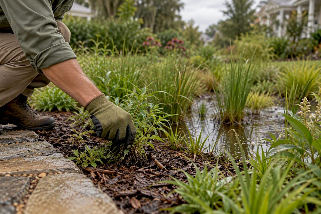
- Bioretention cells and rain gardens: shallow, planted depressions, often at the front of a lot or along a streetscape, that pond briefly during storms then drain into engineered soil media.
- Permeable pavement: pervious pavers or porous concrete, most often used at guest parking or driveway aprons, that let water pass through rather than run off.
- Vegetated swales: grassed or planted channels that carry and slow water along road edges, doing quiet double duty as landscaping.
- Rainwater harvesting: cisterns or rain barrels tied to downspouts, common on individual lots where roof runoff is captured for irrigation.
- Constructed stormwater wetlands: shallow, planted basins that treat larger volumes of runoff before it reaches tidal water, typically maintained at the community level.
Maintenance responsibility usually splits along these lines: individual owners tend to care for lot-level rain gardens and cisterns, while an HOA maintains streetscape bioretention and community wetlands. Every one of these systems depends on pretreatment, whether that means a filter strip, a vegetated forebay, or a sediment trap, to keep sediment and debris from clogging the soil media over time. A bioretention cell without pretreatment is a maintenance headache waiting a few seasons to happen.
Pro Tip: Ask specifically who mows and weeds the rain gardens. If the answer is vague, that feature is likely to fail within a few years, regardless of how well it was designed.
Why Coastal Conditions Change the Rules
The Lowcountry is not a place where standard stormwater manuals apply without modification. Flat ground, tidal creeks, and a water table that rises seasonally all push designers toward different solutions than you'd see inland.
Bioretention design in this region calls for a minimum 0.5-foot separation between the bottom of the cell and the seasonal high groundwater table, along with a design objective to fully drain within about 72 hours. Skip that separation and a rain garden can end up perpetually soggy, breeding mosquitoes instead of filtering water.

Tidal influence complicates things further. A stormwater feature near a creek that floods on a king tide loses effective storage exactly when it's needed most, which is why coastal design guidance often favors constructed wetlands or non-infiltrating systems over standard infiltration basins in those zones. Flat topography adds another wrinkle: without much elevation change to create hydraulic head, gravity-fed infiltration struggles, which pushes designers toward rooftop-oriented solutions like cisterns and green roofs instead. Soil type is the last variable. Very sandy soils raise the risk of pollutants reaching groundwater quickly, while poorly drained clay soils often need underdrains to function at all.
A Buyer's Checklist for Evaluating Stormwater Design
Walking a model home is easy. Verifying that the stormwater plan behind it actually works takes a short, specific list of questions.
- Request the stormwater management concept plan. Ask specifically where the required stormwater runoff volume is retained on-site, and get it in writing rather than a verbal summary.
- Confirm the maintenance and inspection agreement is recorded. Municipal manuals increasingly require these agreements to be tied to the property record, not just mentioned in a sales conversation, so ask who pays and how often inspections happen.
- Walk the site and look for visible LID features. Rain gardens, permeable pavers, and swales should already be part of the plan you're shown, not a future promise.
- Ask about drain-down time. A well-designed bioretention feature should drain within roughly 72 hours after a storm; standing water well beyond that suggests a design or maintenance problem.
- Ask how tidal events and storm surge factor into the design, and whether salt-tolerant plantings were chosen for areas that could see occasional brackish water.
Watch for red flags along the way. A plan built almost entirely around one oversized retention pond, with no distributed LID features, usually signals a developer optimizing for permit approval rather than long-term marsh health. Vague answers about who maintains what, or silence on tidal risk, deserve a follow-up question before you go further.
Pro Tip: Bring the checklist to your first site visit, not your final walkthrough. Developers answer these questions more candidly before a contract is on the table.
How Crane Island's Site Plan Reflects These Principles
The development preserves a significant portion of its land as open space, aligning with runoff-reduction and marsh-protection goals outlined above. With limited homesites, the community avoids the density that typically forces heavier reliance on engineered stormwater infrastructure. Architectural standards inspired by Lowcountry design and access to local waterways complement a site plan built around the land rather than against it.
For readers who want to go deeper on the design philosophy behind these choices, Crane Island's own blog, including entries from John Hillman on architectural context for Lowcountry design, offers a closer look at how site layout and building design work together on Amelia Island.
Why This Matters Beyond the Storm
Stewardship shows up in small, visible details: a rain garden that's actually maintained, a marsh edge that stays clear years after construction. That kind of upkeep protects more than water quality. It protects the porches, the walking paths, and the shared views that make a community worth living in. Buyers who bring the checklist to every site visit, rather than trusting a brochure, end up owning into something built to last.
— John Hillman
Where Preservation and Site Design Meet
This community is an option for buyers who want the checklist above answered before they even ask. A substantial portion of the land remains preserved as open space, architectural standards inspired by Lowcountry design govern builds, and direct waterway access is available to all homesites.
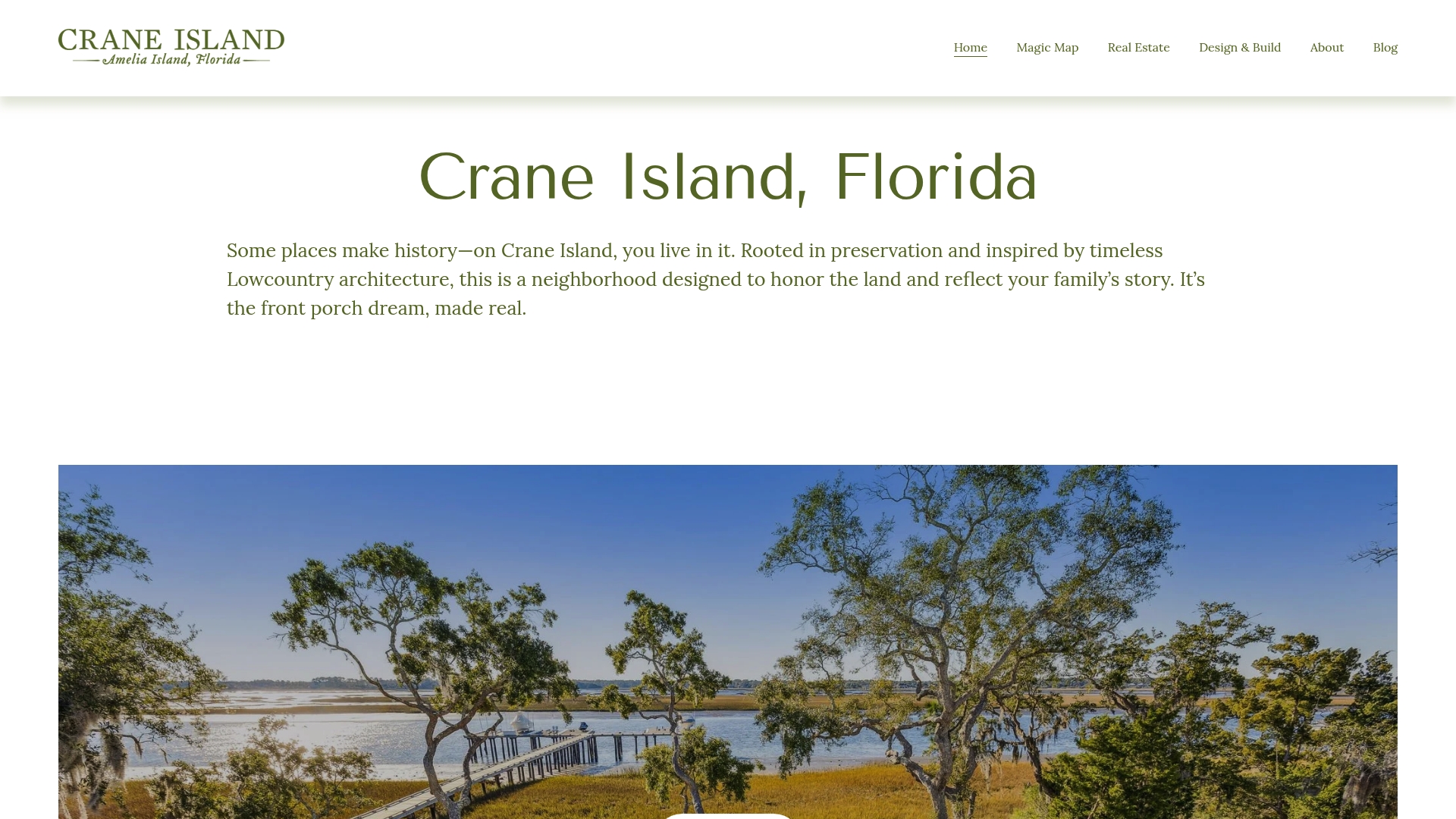
If the site-design questions in this guide matter to you, the next step is simple: look at the available homesites directly, or reach out through the Crane Island Portfolio Homes Program to ask for the property's own stormwater concept plan. With only 14 homesites on offer, the specifics are worth requesting early.
Selected Technical and Regional Guides
- Southern Lowcountry Stormwater Design Manual
- Low Impact Development in Coastal South Carolina: A Planning and Design Guide
- City of Charleston Stormwater Design Standards Manual
- Advancing Low Impact Development in Coastal South Carolina (NERRS project)
Sources
- Southern Lowcountry Stormwater Design Manual
- Low Impact Development in Coastal South Carolina: A Planning and Design Guide
- Design considerations for coastal conditions (LID-in-Coastal-SC chapter)
- Advancing Low Impact Development in Coastal South Carolina (NERRS project)
FAQ
What Is LID/Better Site Design in a Lowcountry Community?
It's a site-planning approach that mimics natural drainage by keeping runoff on-site instead of piping it away, through preserved open space, rain gardens, and permeable surfaces. The Southern Lowcountry Stormwater Design Manual is the regional guide developers follow to meet these standards.
How Much Runoff Does Preserved Open Space Actually Reduce?
Open-space development can cut annual runoff volume by 40 to 60 percent compared to conventional subdivisions, along with lower nitrogen and phosphorus loads reaching nearby water. That's why the amount of preserved acreage in a community's plan is worth asking about directly.
Why Can't Every Coastal Site Use a Standard Rain Garden?
High seasonal groundwater and tidal influence limit where infiltration-based features can work reliably, since design manuals require a 0.5-foot separation between a bioretention cell and the water table. On flat, tidally influenced ground, designers often favor cisterns, rooftop solutions, or constructed wetlands instead.
Does Crane Island Have Published Pricing for Homesites?
Crane Island does not list public pricing for its homesites or homes on its site. Interested buyers can request current details through the Crane Island Portfolio Homes Program.
What Should I Ask a Developer Before Buying a Lot?
Ask for the stormwater management concept plan, confirm the maintenance and inspection agreement is recorded with the property, and ask about drain-down time for any bioretention features. Vague answers on maintenance funding or tidal risk are worth treating as a caution sign.